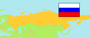
Uchta
Urban District in Komi Republic
Urban District
The population development of Uchta.
| Name | Native | Status | Population Census 2002-10-09 | Population Census 2010-10-14 | Population Census 2021-10-01 | |
|---|---|---|---|---|---|---|
| Uchta [Ukhta] | Городской округ Ухта | Urban District | 127,362 | 121,701 | 96,233 | → |
| Komi | Республика Коми | Republic | 1,018,674 | 901,189 | 737,853 |
Contents: Urban and Rural Places
The population development of the urban and rural places in Uchta.
| Name | Native | Status | District | Population Census 2002-10-09 | Population Census 2010-10-14 | Population Census 2021-10-01 | |
|---|---|---|---|---|---|---|---|
| Borovoj [Borovoy] | Боровой | Urban Settlement | Uchta | 1,916 | 1,560 | 760 | → |
| Jarega [Yarega] | Ярега | Urban Settlement | Uchta | 8,512 | 7,806 | 6,256 | → |
| Šudajag [Shudayag] | Шудаяг | Urban Settlement | Uchta | 3,625 | 3,411 | 2,962 | → |
| Uchta [Ukhta] | Ухта | City | Uchta | 103,340 | 99,591 | 79,899 | → |
| Vodnyj [Vodny] | Водный | Urban Settlement | Uchta | 6,634 | 6,382 | 4,677 | → |
Source: Federal State Statistics Service Russia (web), pop-stat.mashke.org.