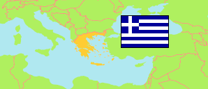
Stereá Elláda
Region in Greece
Contents: Subdivision
The population development in Stereá Elláda as well as related information and services (Wikipedia, Google, images).
| Name | Status | Native | Population Census 1991-03-17 | Population Census 2001-03-18 | Population Census 2011-03-16 | Population Census 2021-10-22 | |
|---|---|---|---|---|---|---|---|
| Stereá Elláda [Central Greece] | Region | Στερεά Ελλάδα | 548,101 | 558,144 | 547,390 | 508,254 | |
| Perifereiakí Enótita Evrytanías [Evrytania] | Regional Unit | Περιφερειακή ενότητα Ευρυτανίας | 20,390 | 19,518 | 20,081 | 17,428 | → |
| Perifereiakí Enótita Evvoías [Euboea] | Regional Unit | Περιφερειακή ενότητα Ευβοίας | 202,131 | 207,305 | 210,815 | 210,778 | → |
| Perifereiakí Enótita Fokídas [Phocis] | Regional Unit | Περιφερειακή ενότητα Φωκίδας | 36,766 | 37,866 | 40,343 | 36,199 | → |
| Perifereiakí Enótita Fthiótidas [Phthiotis] | Regional Unit | Περιφερειακή ενότητα Φθιώτιδας | 163,395 | 169,542 | 158,231 | 137,793 | → |
| Perifereiakí Enótita Voiotías [Boeotia] | Regional Unit | Περιφερειακή ενότητα Βοιωτίας | 125,419 | 123,913 | 117,920 | 106,056 | → |
| Elláda [Greece] | Republic | Ελλάδα | 10,223,392 | 10,934,097 | 10,816,286 | 10,482,487 |
Source: General Secretariat of National Statistical Service of Greece (web).
Further information about the population structure:
| Gender (C 2021) | |
|---|---|
| Males | 254,511 |
| Females | 253,743 |
| Citizenship (C 2011) | |
|---|---|
| Greece | 495,852 |
| EU | 9,253 |
| Other Citizenship | 42,285 |
| Place of Birth (C 2011) | |
|---|---|
| Same municipality | 368,210 |
| Other municipality in same region | 38,494 |
| Other region | 87,609 |
| Other country | 53,077 |