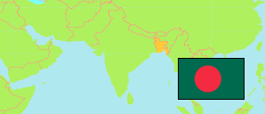
Pabna
District in Bangladesh
Contents: Subdivision
The population development in Pabna as well as related information and services (Wikipedia, Google, images).
| Name | Status | Transcription | Native | Population Census 1991-03-13 | Population Census 2001-01-22 | Population Census 2011-03-15 | Population Census 2022-06-14 | |
|---|---|---|---|---|---|---|---|---|
| Pabna | District | Pābanā | পাবনা জেলা | 1,919,896 | 2,176,270 | 2,523,179 | 2,909,624 | |
| Atgharia | Subdistrict | Āṭaghariẏā | আটঘরিয়া উপজেলা | 124,454 | 136,480 | 157,254 | 178,577 | → |
| Bera | Subdistrict | Bēṛā | বেড়া উপজেলা | 208,897 | 231,430 | 256,793 | 301,476 | → |
| Bhangura | Subdistrict | Bhāṅgurā | ভাঙ্গুরা উপজেলা | 81,624 | 99,474 | 124,433 | 136,570 | → |
| Chatmohar | Subdistrict | Cāṭamōhara | চাটমোহর উপজেলা | 227,524 | 239,973 | 291,121 | 334,223 | → |
| Faridpur | Subdistrict | Pharidapura | ফরিদপুর উপজেলা | 111,464 | 123,919 | 130,335 | 140,398 | → |
| Ishwardi | Subdistrict | Īśbaradī | ঈশ্বরদী উপজেলা | 236,825 | 292,938 | 313,932 | 390,393 | → |
| Pabna Sadar | Subdistrict | Pābanā Sadara | পাবনা সদর উপজেলা | 431,513 | 476,932 | 590,914 | 711,549 | → |
| Santhia | Subdistrict | Sā̃thiẏā | সাঁথিয়া উপজেলা | 283,463 | 323,932 | 380,301 | 410,760 | → |
| Sujanagar | Subdistrict | Sujānagara | সুজানগর উপজেলা | 214,132 | 251,192 | 278,096 | 305,563 | → |
| Bangladesh | People's Republic | Bā̃lādēśa | বাংলাদেশ | 106,314,992 | 124,355,263 | 144,043,697 | 165,158,616 |
Source: Bangladesh Bureau of Statistics.
Explanation: The tabulated figures are not adjusted for underenumeration. 2022 subdistrict figures exclude hijra. Some area figures are derived from geospatial data.