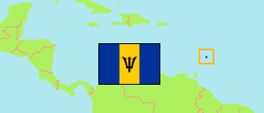
Parishes
The population of the parishes of Barbados by census years.
| Name | Abbr. | Area A (km²) | Population Census (C) 1980-05-12 | Population Census (Ca) 1990-05-02 | Population Census (Ca) 2000-05-01 | Population Census (Ca) 2010-05-01 | Population Estimate (E) 2021-08-01 | ||
|---|---|---|---|---|---|---|---|---|---|
| Christ Church | CC | 60 | 40,790 | 47,050 | 52,922 | 54,336 | 51,184 | 6000 | |
| St. Andrew | AN | 33 | 6,731 | 6,346 | 5,613 | 5,139 | 5,677 | 3300 | |
| St. George | GE | 45 | 17,361 | 17,905 | 19,048 | 19,767 | 21,940 | 4500 | |
| St. James | JA | 34 | 17,255 | 21,000 | 24,270 | 28,498 | 24,819 | 3400 | |
| St. John | JO | 35 | 10,330 | 10,206 | 9,448 | 8,963 | 10,417 | 3500 | |
| St. Joseph | JS | 27 | 7,211 | 7,619 | 7,244 | 6,620 | 6,698 | 2700 | |
| St. Lucy | LU | 35 | 9,264 | 9,455 | 9,991 | 9,758 | 11,136 | 3500 | |
| St. Michael | MI | 38 | 99,953 | 97,516 | 91,025 | 88,529 | 77,394 | 3800 | |
| St. Peter | PE | 31 | 10,717 | 11,263 | 11,405 | 11,300 | 13,565 | 3100 | |
| St. Philip | PH | 60 | 18,662 | 20,540 | 24,566 | 30,662 | 32,130 | 6000 | |
| St. Thomas | TH | 34 | 10,709 | 11,590 | 13,260 | 14,249 | 14,130 | 3400 | |
| Barbados | BRB | 432 | 248,983 | 260,491 | 268,792 | 277,821 | 269,090 |
- The 2010 figures consider an undercount of 18%. The 2021 population estimates are based on the 2010 census because the counted population of the 2021 census (136,415 in total) shows an undercount of 48.7%
- (1980) Britannica Book of the Year 1990.
(1990) The Government of Barbados: State of the Environment Report 2000.
(2000) CARICOM: National Census Report Barbados.
(2010) (2021) Barbados Statistical Service.
Contents: Towns
The population of the major towns of Barbados.
| Name | Adm. | Population Census (C) 1980-05-12 | Population Census (C) 1990-05-02 | Population Census (C) 2000-05-01 | Area |
|---|---|---|---|---|---|
| Bathsheba | JS | 426 | ... | ... | 0 |
| Bridgetown | MI | 7,466 | 6,720 | 5,996 | 0 |
| Hastings | CC | 2,043 | ... | ... | 0 |
| Holetown | JA | ... | ... | 1,087 | 0 |
| Oistins | CC | ... | ... | 1,203 | 0 |
| Speightstown | PE | ... | ... | 2,604 | 0 |
- (2000) Barbados Statistical Service.
Population Structure
Further information about the population structure.
| Gender (E 2021) | |
|---|---|
| Males | 130,037 |
| Females | 139,053 |
| Age Groups (E 2021) | |
|---|---|
| 0-14 years | 42,844 |
| 15-64 years | 176,228 |
| 65+ years | 50,018 |
| Age Distribution (E 2021) | |
|---|---|
| 80+ years | 11,146 |
| 70-79 years | 21,282 |
| 60-69 years | 36,713 |
| 50-59 years | 38,162 |
| 40-49 years | 35,950 |
| 30-39 years | 33,710 |
| 20-29 years | 32,072 |
| 10-19 years | 31,746 |
| 0-9 years | 28,309 |
